Visit the Local History Atlas

About the Atlas
The Local History Atlas was created by Ben Woodward, an award-winning geography undergraduate student and former local museum employee from Southwestern Ontario. Ben created the Atlas based on his experiences preserving, digitizing, and exhibiting museum collections.
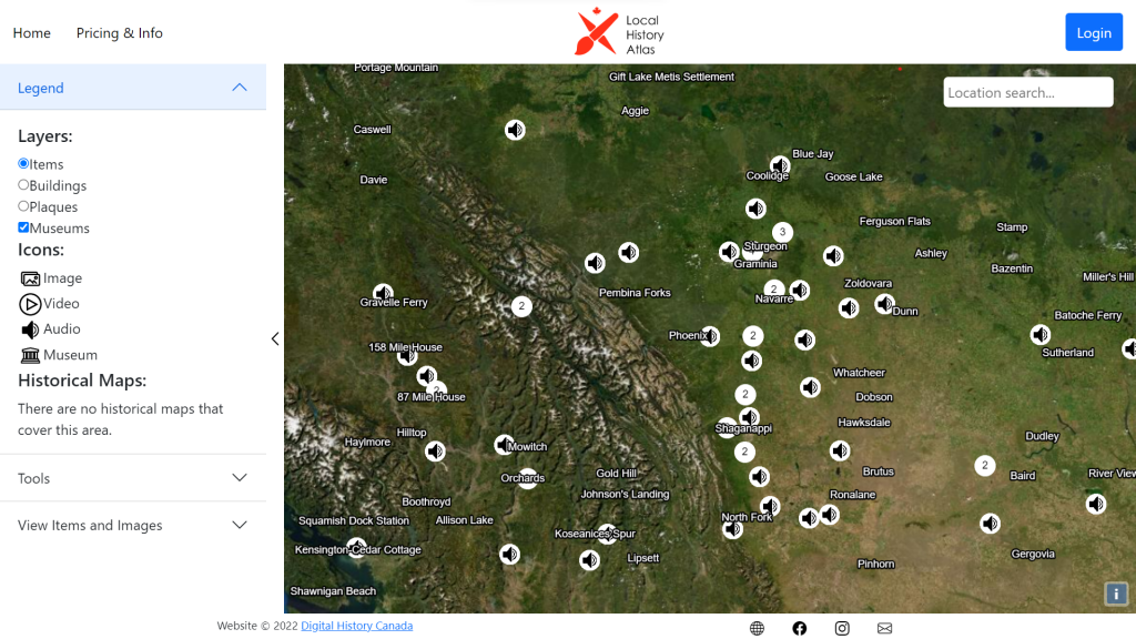
The Atlas is an innovative digital platform that allows you to explore historical maps, postcards, photograph, video, audio, architectural heritage information, plaques, and events posted by museums, archives, historical societies, content creators, and private individuals. The Atlas is designed to create interest in local history by allowing the public to explore rather than search collections to discover new facts about their area’s history. The atlas is designed to pair with existing collections management systems (e.g. Omeka, Access to Memory, PastPerfect, etc.) to help your organization exhibit your collections in a more user-friendly way, solicit information about your collections from local knowledge holders, and encourage either physical or digital donations to expand your collection.
Benefits of Using the Local History Atlas
- Put your museum on the map! Allow members of the public to discover your museum and collections on the Local History Atlas. Putting your collections online will help raise awareness of the amazing and valuable work done by your museum.
- Make your collections accessible! Less than 10% of a museum’s collections are on display to the public at any one time. Add your digitized collections to the Local History Atlas so that the public can view them 24/7 without submitting a research request.
- Pairs with your existing collections management system! Host items on Access to Memory, Omeka, Tainacan, or even FlickR and display them on the Local History Atlas using APIs! Not on one of these collection management systems? Our automated migration services can help you move your collection data to one of them quickly and cost-effectively.
- Affordable and low-risk! Our plans can accommodate organizations of all sizes and start for as little as $5 per month. Further, you can solicit donations through our platform, allowing you to offset some or all of your costs.
Add your Museum to the Atlas
Organizations can add the location of their museum, archive, or historical society to the Atlas for free! Adding your organization to the atlas is a great way to increase awareness of your organization amongst local history enthusiasts and to encourage online donations. To add your organization to the atlas, fill out this form.
Pricing
Local History Atlas plans work for any sized collection and budget, starting at just $5 per month. Do not hesitate to contact us if you are not sure which plan is right for you.
For a limited time, all new web hosting plans, including WordPress, come with a free 1000 item Local History Atlas plan (valued at $35 per month). To learn more, visit our Digital Transformation Services page.
Local History Atlas Plans
Free
- Add your museum, archives, or historical society to the Local History Atlas to advertise your location, hours, admissions, and upcoming events
- Add up to 5 items* to the Local History Atlas
$5 per month
- Add up to 100 items* to the Local History Atlas
- Perfect for small collections, personal projects, or organizations who wish to try the platform before purchasing a more expensive plan.
$20 per month
- Add up to 500 items* to the Local History Atlas
- Enable virtual accessions, which allows members of the public to “donate” digital copies of images from their personal collection to your digital collection, at your discretion
$35 per month
- Add up to 1000 items* to the Local History Atlas
- Enable virtual accessions
$50 per month
- Add up to 2000 items* to the Local History Atlas
- Enable virtual accessions
*An item is any one of a photograph, postcard, video, audio clip, heritage building, or historical event. Maps are not considered items and are priced separately.
Digitized Historical Maps
$2 per map per month*
- Add your high-resolution scans of historical maps to the Local History Atlas so that users can view them and compare them to other maps and modern-day aerial imagery
- Have us professionally georeference and upload your scanned maps for an additional one-time charge of $5 per map
*Special pricing is available for larger map collections
Demo
Watch this video for a demonstration of the key features of the Local History Atlas. To book a live demo, email us at digitalhistorycanada@gmail.com.